Martin Luther King

D-12-01-18-6556_61 (MLK Birthday)
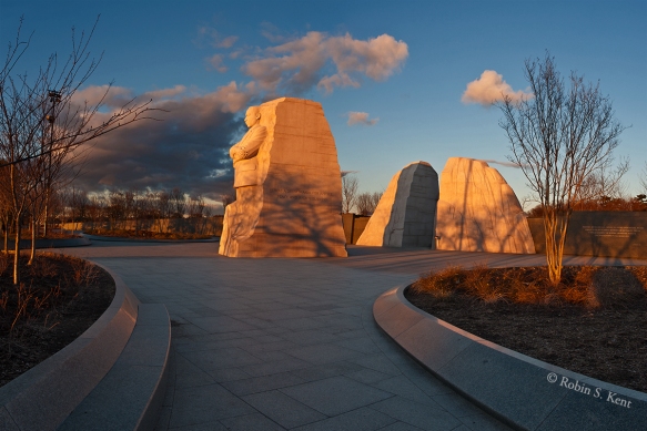
Sunrise, Martin Luther King Memorial

“I believe that unarmed truth and unconditional love will have the final word in reality. This is why right temporarily defeated is stronger than evil triumphant. I have the audacity to believe that peoples everywhere can have three meals a day for their bodies, education and culture for their minds, and dignity, equality and freedom for their spirits. I believe that what self-centered men have torn down, men other-centered can build up.”

Words excerpted from Martin Luther King’s speech accepting  his Nobel Peace Award,  Oslo Norway, December 10, 1964.


Low Light Photography (Part 3)


 Low Light Moon 1503-36Moonrise, Lincoln Memorial

 Photographing the moon, stars, and the Milky Way brings a different set of challenges, most often in planning where to be and when.  Happily, this is no longer as hard as it used to be,  because there are various apps such as The Photographer’s Ephemeris (TPE) or PhotoPils that enable you to predict where the moon and other astronomical bodies will be at any given time and location.

The picture above was taken in 2001 when such things did not exist. You needed a compass and a chart with the azimuth of the moonrise.  On March 9th, the moonrise was at 6:19 PM, 10 minutes after sunset.   

Low Light D-09-09-05-51_52_53 (Moonrise, Washington) Moonrise over Washington DC 

(Tech: Nikon D200 with 18-200mm f/3.5-5.6 lens, @ 200mm, exp:  1.8 sec. @ f/5.6, ISO 200; 3 vertical images, photomerged)

Capturing a full moon rising over Washington, DC from this location near the Netherlands Carillon is a much desired goal of many local photographers.  These days, when the alignment is expected to be good, you will find as many as 100 photographers at this location poised for the opportunity.

The image above, however, was photographed on Sept 5, 2009, the night after the full moon, and also back before TPE and other apps were generally available.  There were less than a half dozen photographers up there that night.  The next chance for an almost identical shot at this location will be on October 5, 2019.

Low Light D-11-05-28-8051_58 Iwo Jima Iwo Jima and Crescent Moon

The moon doesn’t necessarily have to be full to find an interesting angle, but it might mean that you have to get up early in the morning.  This was taken at about 5:20 AM, during civil twilight when the waning moon was about 19% full.

(Tech:  Nikon D200, 18-200 f/3.5-5.6 lens at 200mm; exp 0.6 sec. @ f/20, ISO 2500)

Low Light D-14-10-08-2014 EclipseLunar Eclipse Multiple Exposure

(Tech: October 8, 2014, Total of 18 Exposures over a 64 minute period, exposures varied depending on brightness of moon)

A lunar eclipse is a relatively rare event, but it can be photographed in a variety of ways depending on the timing and track of the moon across the sky.  In this case of an early morning eclipse, I tried an application of the stacking technique I learned in a Michael Frye workshop for shooting star trails (discussed below).  The next total eclipse in Washington, DC will be on the night of 20-21 January 2019.  Information of the date and locations of upcoming eclipses anywhere can be found here.

Low Light D-14-08-23-3525 (Gaylor Lake)Milky Way over Gaylor Lake, Yosemite National Park

When photographing Stars, one has to get away from the light pollution of city lights.  Dark skies, such as Yosemite National Park, are increasingly rare.  One place to find them is at the Dark Sky Association website.

This kind of photography involves a number of considerations.  According to Michael Frye: “Capturing pinpoint stars requires relatively short exposures, otherwise the stars become streaks instead of points. You can get away with exposure times as long as 30 seconds with wide-angle lenses.  To gather enough light to show faint stars and the Milky Way with such short exposures, you need both a wide aperture and a high ISO. The wider the aperture and the higher the ISO, the more stars will appear in your photograph. But you might not want to use the widest aperture on your lens, because all lenses are sharper when stopped down a bit. Or if you have something in the foreground you may need to stop down slightly to get sufficient depth of field.  To start with, try 15 to 30 seconds at f/2.8, with the ISO at 6400. If that doesn’t show enough stars, try a wider aperture or higher ISO.”

The Milky Way is not visible in the Northern Hemisphere during January and February.  For a comprehensive discussion of when and where to photograph it, check this link.


Low Light (Star Trails) D-13-09-08-3496Star Trails, Sonora Pass, California

The technique for capturing star trails is similar to shooting the Milky Way in that a fast (f/2.8 or better) wide angle lens (24 mm or wider)are necessary.  But instead of one relatively short exposure, this kind of image requires a series of long exposures at a relatively low ISO.  The above image involved 30 separate exposures, each four minutes long with a 1 second interval between each one.  The aperure was f/5.6 and the ISO was 400.  An intervalometer was attached to the camera to manage the sequence of shots.

Then, during postprocessing, you can load all the images into photoshop as layers.  You then click off the visibility (the little eyeball on the left of each layer) of all layers except the bottom layer.  Then Cchange the blend mode on all layers to “lighten” and the star trails will appear.  This action blends the layers together keeping only the lightest areas of the photo.  Merge the image as a single layer.

I hope these three posts on low light photography are of some use to readers interested in taking on the low light challenge.  For now, however, I will be taking a break from my blog for about 6 weeks as I get ready for an upcoming trip to the monarch butterfly preserves in the Sierra Madre Montains of central Mexico.  You can get an advanced peek at what I hope to see there by checking out my post from 2016.

You cn also check out my Instagram feed (@photographybykent) which will have occasional posts over the next several weeks.  In the meantime,

Keep Shooting……….


Low Light Photography (Part 2)


As mentioned in last week’s post, possible subjects for night-time shooting include cityscapes, landscapes, a staged scenario, and astronomical phenomena.  In the case of cityscapes, one does not have to live in, or travel to, well-known cities such as Washington, DC, New York City, or Paris.

Low Light (Hartford) D-14-12-04-5599_606Hartford at Twilight

(Tech: Nikon D800E with 24-70mm f/.28 lens @ 50mm, 3 sec. @ f/16, ISO 400, photomerge)

This was taken during the Nautical Twilight phase, but by looking west, one can still see plenty of light in the sky.  The location was chosen because there was good illumination from city lights over most of the scene and the Connecticut River provided  a nice reflection of the city lights.  Using water to reflect lights can be a very effective technique at night.  As before, the glare from the brighter lights was managed by using a small aperture to produce a star effect.

Low Light (Pittsburgh) D-13-08-17Pittsburgh at Night

(Tech: Nikon D800E with 70-200mm f/2.8 lens @70mm, 1/6th sec. @ f/2.8, ISO 1600)

From this location (an overlook in the 1400 block of Grandview Avenue), the city of Pittsburgh provides a dramatic night scene with plenty of illumination.  However, the moving ferry in the river required a relatively short exposure, forcing a setting at a wide aperture and high ISO.

Tactics for Adding Interest

Aside from looking for potential reflections, one can also look for illuminated fountains, use time exposures to  incorporate traffic flow, or take advantage of a special event such as temporary art installations or fireworks.  The city of Washington, DC has many fountains although most are shut down for the winter.

Low Light (WW II Mem) D-13-06-01-9189_209WW II Memorial at Twilight

(Tech: Nikon D800E with 24-70mm f/.28 lens @ 24mm, 8 sec. @ f/14, ISO 400, photomerge)

The primary reason for using a photomerge in this case was to “remove” the tourists in the scene.  About 17 separate exposures were made, each of a small section of the scene that did not have anyone in it at that moment.  Depending on the situation, there are easier ways to do this in Photoshop, such as the Image Stacking Mode or the Scripts-Statistics  process.  But those techniques have difficulty with any moving object, such as a flag or moving water, that appears in every image.                                                                                   Low Light (Bartholdi)D-11-09-16-2649  Bartholdi Fountain at Twilight

(Tech: Nikon D800E, 24-70mm f/2.8 lens @ 56mm; 10 sec. @ f/16, ISO 400)

 This fountain, dating back to 1876, was created by August Bartholdi, a French artist who is better known for the Statue of Liberty.  It is located in Bartholdi Park across Independence Avenue from the US Botanic Garden.

Fountains can be found in most cities around the world; Rome and Paris (see image below) are famous for their fountains,  but Kansas City reportedly is second only to Rome in the number of municipal fountains.

Low Light (Paris Fountain) brighter D-14-06-04-8826_27Place Concorde at Twilight, Paris

(Tech: Nikon D800E, 24-70mm f/2.8 lens @ 24mm; 5 sec. @ f/16, ISO 200)


Moving traffic can pose a problem for night photographers, but, by using a long exposure to create trace lines, what might be a flaw becomes a strength.

 Low Light (Kutz Bridge) D-11-03-13-4100Washington Monument and Kutz Bridge

(Tech: Nikon D800E, 24-70mm f/2.8 lens @ 38mm; 8 sec. @ f/16, ISO 200)

When shooting at street level, the brightness of oncoming headlights can still be a problem, even with a long exposure.  Here the traffic was going away from the camera so only the taillights and the blue warning lights from the police car were visible.

This technique does not have to be restricted to street vehicles.  For locations near an airport, aircraft landings and take-offs can also be included as shown in the next two images.

Low Light (Final Approach) D-10-03-20-050Final Approach Over Key Bridge

(Tech: Nikon D200, 18-200 f/3.5-5.6 lens @ 42mm; 30 sec. @ f/16, ISO 100)

There are several locations where you can capture aircraft landing at National Airport.  This was taken on the river’s edge about 200 feet northwest of the Thompson Boat Center.

Low Light (Kennedy Center) D-17-11-29-0794Kennedy Center at Night

(Tech: Nikon D850, 24-70 f/2.8 lens @ 70mm; 20sec. @ f/18, ISO 100)

Special event illuminations such as the recent display by the Kennedy Center can provide unique opportunities because they usually only last for a short time.  This image combines several of the tactics discussed here: a special illumination, trace lights from vehicle traffic and aircraft, and using water to add reflections.

The next and final post in this series will cover astronomical phenomena, photographing the moon, stars, and the Milky Way.

In the meantime, Keep Shooting…………..


Low Light Photography (Part 1)

Low Light (Pilings) D-07-08-25-0028Moon over Abandoned Pilings, Marquette, Wisconsin

Recently, I was asked by a local camera club to give a presentation on “Low Light Photography” and I thought perhaps an abbreviated version might be worthwhile on my blog.

Because the majority of my photography involves landscape scenes and urban architecture, I decided to concentrate on that area, even though low light scenarios can occur in many other situations such as when you are indoors and cannot use a flash.

Low Light (Shuttle) D-07-07-02-0057Night at the Museum, NASA Shuttle Enterprise in the Udvar-Hazy Center  

The above image is not typical of what I do, but when an opportunity arises to get inside a major museum after closing, you don’t pass it up.  Especially if it’s authorized.

For me, however, twilight is a classic example of how a low light situation can present opportunities for especially dramatic images that are not possible during daylight hours.

Low Light (Mid-Hudson 01) 2137-33Mid-Hudson Bridge, Afternoon Scouting Image

Low Light (Mid-Hudson AM) 2138-02Mid-Hudson Bridge at Dawn, (the next morning)

We all know we that twilight is a relatively short period of time after the sun has gone below the horizon.  Even though the sun has disappeared,  scattered sunlight from the atmosphere continues to provide illumination.

Low Light GraphicTransition from Day to Night

But there are three different categories of twilight, based on how far the sun is below the horizon as shown in the chart above.  Understanding those three categories is important because the quality of the light and therefore one’s photograph changes significantly depending on how long it’s been since sunset. It also depends on whether you are pointing your camera away from the location of the sunset/sunrise or toward it.

So let’s look at some examples.

Low Light (WW I MEM) D-14-06-28-1750 
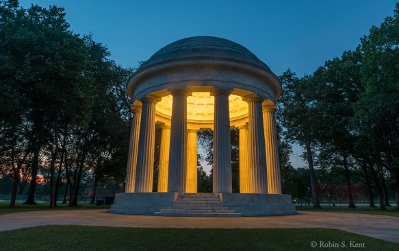
WW I Memorial at Twilight, Washington, DC

(Tech Data: 19 Minutes after Sunset, Civil Twilight, looking Northwest 1.6 sec., @ f/16, ISO 400, Nikon D800E)

Here, during the first phase of twilight, there is still a fair amount of ambient light to show detail in the subject and the sky is taking on the classic blue of the “Magic Hour.”


Low Light (Kennedy Center) D-13-03-17-6064_70Kennedy Center at Twilight, Washington, DC

(Tech Data:  40 Minutes after Sunset, beginning of nautical twilight, looking Southeast, 1.3 sec @ f/5.6, ISO 400, Nikon D800E)

Here, the sky is much darker, in part because it is a bit later than the previous image and also because the camera is pointing away from the western horizon.  The image also demonstrates another technique that can porduce a more dramatic look at night: the use of a reflection in a body of water, be it river, pond, or rain puddle.

Low Light (WW II Mem) D-11-04-30 7062_63 WWW II and Washington Monument at Night

  (Tech Data: 51 Minutes after Sunset, near the end of nautical twilight, looking East, 6 sec. @ f/16, ISO 400, Nikon D800E)

 Low Light (Ferris Wheel) D-13-07-19-044County Fair with Moon, Madison, Wisconsin

(Tech Data: 1 hour 51 minutes after Sunset, after end of Astronomical Twilight, looking generally East, 5 sec. @ f/16, ISO 100, Nikon D800E)

The glare (a typical problem for night shooting) was managed by using a small aperture to get the star effect which is more attractive than a blown-out spotlight or street lamp. It’s also good idea to use the lens shade when shooting cityscapes at night, to minimize glare from bright lights just outside the composition .

There are many possible subjects for night-time shooting, including cityscapes, landscapes, a staged scenario, and astronomical phenomena.  We’ll go into that in Part 2 of this series.

In the meantime, I would be interested in comments from readers about low light situations you have encountered and how you resolved them.  I expect to be speaking on this subject again and it would be great to bring in some additional ideas .

Until, then…Keep Shooting


Iceland (Part 6) Southern Region

Map of Chapter 6 Crop JPEGMap of Southern Region

Our next overnight was at the Hrifunes Guest House, a charming inn off the beaten track.  Hrifunes is jointly owned by Hadda Gisladottir who traveled with us for the first several days of our journey and by our photography guide Haukur Snorrason.  The meals are served family style and we can attest to the excellent skills of their kitchen staff and the comfort of the rooms.  As I mentioned in Chapter 1 of this odyssey, Hadda primarily manages the guest house while Haukur primarily manages the photo tour operation.

D-17-06-12-001 (Iceland)View from the Reading Room, Hrifunes Guest House

D-17-06-12-002 JPEG (Iceland)Dining Area of Hrifunes Guest House

The next morning we headed off for the Valley of Thor, an area  without roads, bridges,  hotels, or restaurants. But that will be the subject of the next post.  We still had a number of stops on the way.

It didn’t take long for Haukur to abandon the main highway for a destination he had previously spotted from his plane when scouting for remote photo locations.  Needless to say, we had this location all to ourselves.

D-17-06-11-7213 (Iceland)
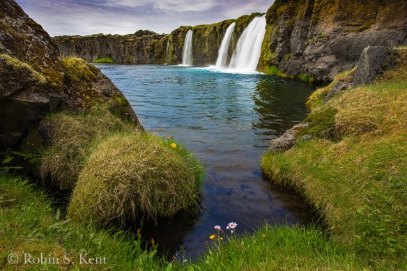
Undisclosed Location, Southern Iceland


After returning to the main road, we spotted a large field of lupine that seemed to be calling for us to come and photograph it.

D-17-06-11-7267_74 (Iceland)Field of Lupine

The small village of Vik is an excellent place to stop for lunch and/or stroll along a black sand beach and/or capture some images of the hillside church above the village.

D-17-06-11-7314 (Iceland)
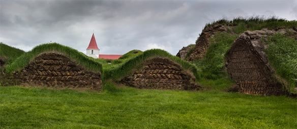
Hillside Church Overlooking Vik and Reynisdrangar Sea Stacks

After lunch, we were planning to check out the Dyrholaey Lighthouse, but the road was jammed with traffic and so we opted for a nearby spot which gave us an excellent overview of Arnardrangur, a massive basalt monolith standing on Reynisfjara, the black sand beach.

D-17-06-11-7359_64-Pano (Iceland)Arnardrangur, with Reynisdrangar Sea Stcks in the Distance

A short distance from here, we came upon Skogafoss, one of the biggest waterfalls in Iceland.  Its name comes from the Skoga River which tumbles over a 200-foot cliff befopre continuing to the sea some 3 miles away.  At one time, the coastline was marked by these cliffs, but receded long ago.  The river below the falls holds a large salmon and char population and is popular with fishermen between July and October.

D-17-06-11-7388 (Iceland)
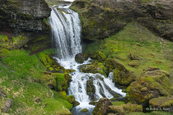
Skogafoss, Mid-Afternoon Light

This picture is somewhat deceptive because this is a popular tourist stop and several hundred people were there with us.  But almost all were behind us to avoid the mist or climbing the 370 steps to the top of the falls where there is an overlook.

As one travels along the Route 1 in Iceland there are numerous farms on what appears to be a wonderfully serene landscape of waterfalls and/or snowcapped mountains. We stopped briefly at one that seemed especially nice as shown in the image below.

D-17-06-11-7400 (Iceland Blog 2)
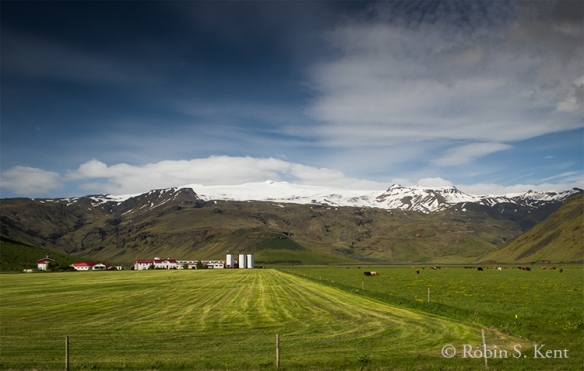
Family Farm in Idyllic Setting

But upon examining an explanatory sign next to the entrance road, we discovered that there is a downside to some locations.  In the case of this property, that downside revealed itself on April 14, 2010 with the eruption of Eyjafjallajökull.  We would be headed in the general direction of that volcano next.  But Haukur didn’t seem concerned.

Google Image


Next:  Into the Valley of Thor……

Iceland (Part 5): Eastern Region


Detail Map of Area near Jokulsarlon

After four consecutive days in a different hotel every night, we slowed the pace a bit and signed up for two days at the Hali Country Hotel, just up the road from the famous Jokulsarlon glacial lagoon and the black sand “Ice Beach.”  Our guide, Haukur, had also arranged for an early morning visit to a puffin colony at Cape Ingolfshofdi.

View from the “Trail” leading down from Cape Ingolfshofdi  as we return to the SUV

Puffins spend most of their lives living in the open ocean but in the spring many of them flock to coastal colonies in Iceland.    But it takes some effort to get close to them as the image above suggests.  There was no road and no visible trail to the base of the promontory where the puffin colony was located.  The several kilometers of splashing through marshes and undulating fields of soft lava ash makes one imagine they are testing a prototype for a new carnival thrill ride.  Then comes the hard part, trudging with a pack of camera gear up a steep slope of lava ash and sand, something akin to climbing a sand dune.

But at the top, one finds a field of lush green grass which stretches out invitingly….to a sudden drop off a vertical cliff high above the ocean.  The puffins nest in burrows they have found or excavated themselves, bringing in grass and feathers as lining for the chicks.

The puffin’s diet consists almost entirely of fish, which it captures by swimming under water using its semi-extended wings as paddles and its feet as a rudder. We couldn’t stay too long in any one spot because the puffins would wait until we were a safe distance before entering their nests and feeding their young.

As cute as the puffins are, their neighborhood has a bad element…a large thug of a bird known as the great skua.  The skuas build their nests on the ground out in the open, almost as bait for naïve trespassers whom they attack with with fiendish glee .

When a bird this large (4-foot wing span) is heading directly at your face…….

The Jokulsarlon glacial lagoon is not far from Cape Ingolfshofdi and is a favorite stop for most visitors because of its dramatic scenery, easy access, and its full range of services (café, souvenirs, boat rides, etc.)  Icebergs breaking off the Vatnajökull glacier float in the lagoon eventually working their way out a narrow channel into the ocean.  Once in the ocean, many will be pushed up by the tide onto a black sand beach, the famous Ice Beach, providing numerous opportunities for photographers.

Jokulsarlon Glacial Lagoon

At the back of the parking lot away from the tourists, a flock of Arctic Terns had taken possession of a field  for a nesting colony.  The tern is famous for its incredibly long migration route, the longest-distance migration of any bird, moving between its Arctic breeding grounds in Iceland and Greenland and its non-breeding territory in the Antarctic, a distance that approaches 25,000 miles. And they share one characteristic with the skua: the ferocity of their attacks on trespassers.  Although they are much smaller, they use a team approach, overwhelming the target with their numbers.

(Nikon D810 & 24-70mm f/2.8 lens @ 70mm; 1/5,000th sec @ f/7.1, ISO 400)

There is a second glacial lagoon, Fjallsarlon,  just a few miles down the road from the far more popular Jokulsarlon.

Rick and Michele setting up their shots at Fjallsarlon

The lagoon is smaller than Jokulsarlon; there are no tourist services and the water is not as blue.  But the solitude was a nice contrast.  When it was time to leave, Haukur suggested a short hike to some nearby ponds where we might find some geese.

Barnacle geese with goslings

One of the most magical experiences on any Iceland tour is a visit to the Ice Beach.  It is here that the last remnants of a dying glacier wash up on a black sand beach and complete their thousand-year life cycle.  These stranded crystal sculptures seemed almost alive as the surf swirls around them, refracting and reflecting the dim light of the late evening.

Last Vestiges of a Glacier


Next:  Lupines and More…….

Iceland (Part 4): Lake Myvatn Region

Map of Day 4 Merged (JPEG)

The Lake Myvatn Region derives its name from the large lake of that name and is characterized by a violent landscape created by numerous volcanic eruptions over the past 3,000 years.  We were reminded throughout the day that there still is considerable power and heat below the surface on which we walked.

On this morning, we awakened to find that the snow had continued overnight long enough to change the character of the scenery. It was hard to believe this was early June.

D-17-06-07-3862_64-Pano (Volcano)Volcanic Crater, Early Morning after a Snowfall

D-17-06-07-3776_77-Pano (thermal park)

Namafjall Geothermal Field

An early start enabled us to arrive at the popular Namafjall geothermal field before the crowds and we had the place to ourselves.  It reminds one of Yellowstone with the many mud pots, fumaroles, and venting hydrogen sulfide gas.

D-17-06-067-3822 (Iceland)Namafjall Geothermal Field


D-17-06-07-3872_74-Pano (Iceland)Unnamed Lagoon, Somewhere on Highway 1, Lake Myvatn Region

D-17-06-07-3984 Crop (sheep)
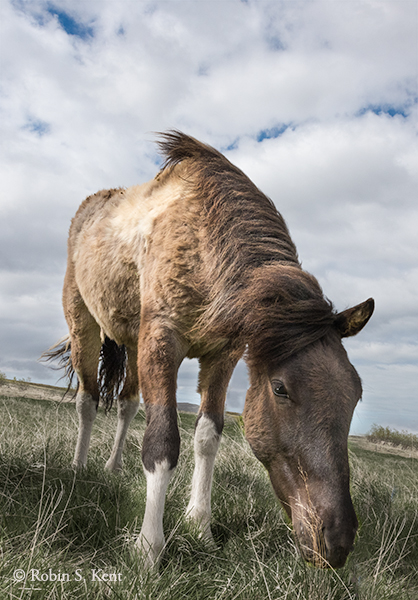
Lamb with its Mother, Somewhere on Highway 1, Lake Myvatn Region

D-17-06-07-3989_94-Pano (Iceland)
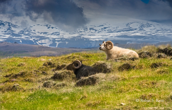
Snow on Mountains, Somewhere on Highway 1, Lake Myvatn Region

As we drove we west on Highway 1, we were repeatedly confronted with scenic opportunities and they were coming so fast that we failed to record the locations of the above three images.

The afternoon was spent hiking around the Leirhnjukur area, a name which means “clay hill” and refers to a porous hill of rhyolite rising 150 feet above a surrounding lava field.   Steam is venting  through the rhyolite and in some places it has turned to clay.  The hike takes one up the hill, through some rugged lava formations, thermal pools, and numerous  steam vents.  One can’t help remembering that Kafla, a nearby volcano responsible for much of what we were seeing, last erupted in 1984 which really wasn’t that long ago.

D-17-06-07-4054_55-Pano (Iceland)Leirhnjukur, View from the Trail (note hikers on top of the hill)

D-17-06-07 SONY 1456 (Iceland)View from the Overlook, Leirhnjukur (Trail is along near edge of black lava field)

D-17-06--07-4178_80-Pano (Iceland)View from Leirhnjukur (Taken just before we began the descent back down to the car)

The name Dettifoss could be loosely translated as ‘The Collapsing Waterfall’. Considered to be the most powerful waterfall in Europe, it plummets into a gorge which is 330 feet across and about 144 feet straight down. The water comes from the nearby Vatnajökull glacier, the largest glacier in Europe, whose sediment-rich runoff colors the water a greyish white.

D-17-06-07-4240_41-Pano clone (Dettifoss)Dettifoss, View from East Side

(For scale, note small black hiker at edge of falls on opposite side)

D-17-06-07-4262 (rdy2size)Dettifoss, View from East Side (Taken from the edge of cliff about 50 feet above the river)

Selfoss, a smaller waterfall is an easy 1-mile hike upstream from Dettifoss.  Not as high, but its horseshoe shape is rather elegant.  When the water is running higher than when we were there, it would have been even more impressive with numerous cascades falling off the edges of the canyon walls for several hundred meters on both sides.

D-17-06-07-4312 (upper falls)Selfoss, View from East Side

(The pools of standing water in the foreground are often part of the cascade)


Next….the Famous “Ice Beach”

Iceland 2017, Part 3:  The Northern Tier


Iceland 2017 Day 2 Map JPEG (Final)

Map of Day 2

Over the next two days we crossed the northern section of Iceland, checking out a few of the well-known stops and making occasional forays into less-traveled areas.  The area is a starkly beautiful landscape of geothermal features, bizarre lava formations,  steaming fumaroles and volcanic craters. We also experienced a full range of Iceland’s notoriously fickle weather patterns: sunshine, overcast skies, rain, sleet, snow, high winds, no wind and even sub-freezing temperatures.  It made for some interesting photographic challenges.

The north is less frequented by tourists due to the distance from Reykjavik, but has much to offer, ranging from historical and cultural sites, unique landscapes, and unexpected roadside photo ops.

Day 2 started with a turn off the main Ring Highway (Route 1) onto Route 715, a dirt road that leads to  Kolugljufur Canyon and a pair of waterfalls on either side of a short bridge.

D-17-06-06-3239_40-Pano (Kolugljufur)

Kolugljufur Canyon, Photographed from the Bridge

D-17-06-06-3187 USM (Kolugljufur)

Kolugljufur Canyon, about 100 Meters Downstream from the Bridge


We had several opportunities to stop whenever we saw an interesting roadside scene.  One example is an abandoned house alongside a cascading stream shown in the image below.

D-17-06-06-3278_80-Pano (Abandoned House)

Abandoned House, Skagi Peninsula, Somewhere along Route 744.


D-17-06-06-3313_14-Pano (Turf Farmhouse)

Icelandic Turf House with Connecting Rooms


The turf farmhouse in Glaumbaer is a great place to learn about Icelandic history.  A farm has  been on this site since the 9th Century.  Turf houses date from those earliest days but the buildings here are more recent, constructed in the 18th Century.  There is also a small museum and a Tea House which serves light fare featuring Icelandic dishes.

Back on the road our guide, Haukur Snorrason, demonstrated once again his ability to sense when an unplanned opportunity might arise.  As we approached a large pasture containiing about 20 Icelandic horses, he chose to pull over saying that it looked like something was about to happen. Little did we know.

D-17-06-06-3509 Crop (Horseplay)

Icelandic Horseplay

D-17-06-06-3404 Crop (horses)

No animals were harmed during the filming of these pictures

It seemed that as soon as one pair became bored with their game, another pair would start up.  We didn’t want to leave them, but our primary goal for the day was Godafoss, the Waterfall of the Gods.

D-17-06-06-3588 (Godafoss) copy

Godafoss, in a Light Rain

The waterfall derives its name from the year 1000, when Iceland converted to Christianity.  The head of the island’s legislature, known as the law-speaker,  dispensed his pagan gods by throwing them into this waterfall as a symbolic act of the conversion.

For us, the chief problem was the deteriorating weather.  As the rain became heavier and temperatures began to fall, we cut our visit short.   As we headed east, the rain turned to sleet and then to snow and shortly afterwards, we spotted a pair of fly fishermen standing in the middle of a river, oblivious to the weather.

D-17-06-06-3661 (Fishermen)

Fly Fishermen in Snowstorm

Next…the Myvatn Region


Iceland 2017, Part 2:  The Road Trip Begins


Day 1, 8:00 AM:   Right on time our guide, Haukur Snorrason, arrived at our hotel and soon we were heading west out of Reykjavik. Also with us was Hadda Gisladottir. She and Haukur are the joint owners/operators of Phototours and the Hrífunes Guest House where we would be spending the penultimate night of the trip.

Day 01 Map Merged

Route on Day 1

In the months prior to our arrival, our email exchanges with Haukur provided a wealth of options for consideration.  His extensive experience as an Icelandic  photographer and guide helped us develop an ambitious plan. It included several well-known and frequently photographed locations, a generous number of lesser known spots that he suggested, and some built-in time to take advantage of a few unexpected opportunities that might arise.  And now we were finally underway, eager to experience whatever lay ahead of us.

D-17-06-05-2603 (Iceland)

Overview of Hraunfossar

Within a few hours we were overlooking Hraunfossar (Lava Falls), a 900-meter wide lava field that originated long ago from a volcanic eruption beneath the Langjökull glacier.  The 40-mile long field is porous, enabling  glacial meltwater and rainwater to move  through it until reaching the terminus at the Hvítá River where it emerges as countless waterfalls cascading into the river.

Next up, an arranged stop at a nearby working farm where we could fraternize with some of the famous Icelandic horses (For more on this delightful animal, check my 2015 post here.   

D-17-06-05-2780 (Michele)

With socialable and curious personalities, Icelandic horses love to engage visitors

D-17-06-04-2846 Crop (Iceland)

So friendly you need a super-wide (e.g., 14-24mm) to capture the entire animal.


D-17-06-05-2822 and 24 (Iceland)

The sheep on this farm know where to position themselves for a picture

Iceland’s landscape is a magnet for tourists and has made the tourist industry an important economic sector.  But the landscape also provides an even more significant economic benefit: renewable energy.   One such source is geothermal energy and so we made a brief stop at Deildartunguhver, Europe’s most powerful hot spring.  The water emerges at 207°F and is moved via pipelines to provide hot water and central heating for towns as far as 40 miles way.   Overall, Iceland satisfies 87% of its demand for hot water and heat with geothermal energy, a key aspect of its energy strategy.

D-17-06-05-SONY-1435 (Iceland)

The Hot Water Pumping Station at Deildartunguhver


A hidden waterfall is always a special treat and our first one was a short hike from a highway in Snaefellsnes, a peninsula in Western Iceland.  Other than a vague sign at the pull-over stop, there was no hint that this 30-foot cascade was less than 200 yards away.  Perhaps six other people came by while we were there.


D-17-06-05-SONY 1442A (Iceland)

Roadside Waterfall (1/800th sec. @ f/10)

D-17-06-05-2934 (Iceland)

Detail of Cascade (0.4 sec @ f/16 with ND Filter)

The Kirkjufellfoss waterfall, however, with Kirkjufell Mountain as a dramatic backdrop, is one of the country’s major attractions and a good number of people were here when we arrived.  Still, with careful timing, a bit of patience, and use of the photomerge technique, one can get an image containing no tourists.

D-17-06-05-2975_76-Pano (Iceland)

Kirkjufellfoss waterfall

(Two images photomerged; 24 mm lens, 0.8 sec. @ f/20 with ND Filter)


D-17-06-05-3018_20-Pano (Iceland)

Lupines bloom in June, usually peaking around the 2nd and 3rd weeks of the month and are a common sight at this time of year. This field was well off in the distance and probably would have been unnoticed by most travelers.  But Haukur suggested we take a detour off the main highway onto a dirt road to check it out.


D-17-06-05-3090 Crop & Clone (Iceland)

Icelandic Horses, Afternoon Light

Another unexpected opportunity appeared about 40 minutes after the field of lupines, so we stopped again, grabbed our telephotos, and fired away.  And again, this was a scene we had to ourselves.

After checking into the Gauksmyri hotel, we departed immediately for another well-known location, the site of Hvitsekur Troll Rock, a sea stack just off the shore of Vatnsnes peninsula.  We arrived at the perfect time; it was low tide and the sun was about to set.  On the downside, it was quite cold (around freezing) and very windy.  But perhaps because of those factors, along with the late hour (about 11:00 PM), only a couple of other people ventured down to the beach.

D-17-06-05-3124_25-Pano (Iceland)

Hvitsekur Troll Rock at Sunset

Next: Across the Northern Tier……..


Iceland, Part 1: Reykjavik


D-17-06-04-2412_16-Pano (Iceland)

Overview of Reykjavik, from the observation deck of the Hallgrímskirkja Church

Virtually everyone who travels to Iceland begins and ends their visit in Reykjavik, the northernmost capital city in the world. Despite its location just below the Arctic Circle, Iceland’s climate is milder than one would expect due to the influence of ocean currents such as the Gulf Stream.  At the same time, summers are quite cool, with lows in the 40s and sometimes below.

D-17-06-04-1418 Sony (Iceland)

A typical side street in Reykjavik, with a decidely non-urban backdrop featuring Iceland’s dramatic landscape.

The name Reykjavik translates roughly as “Smoky Bay,”  a reference to the steam rising from geothermal vents observed by early Viking settlers in the 9th Century.  The island currently has a population of about 330,000 persons, yet more than 2/3 of them reside in the capital region.  By comparison Fairfax County, Virginia where I live, has over 1 million inhabitants.

D-17-06-12-8076 (Iceland)

A view up the the hill toward the Hallgrímskirkja Church around midnight in early June.

Perhaps the most impressive aspect of Iceland’s history is that it has the oldest parliament in the world. The “Alþingi”  was established as an outdoor assembly around 930 AD and was moved to Reykjavik in 1844.  Its survival during a long and often turbulent history enabled the country to maintain a semblance of control over its political destiny even as it became part of the kingdom of Norway in the 15th century and eventually under Danish control.  World War II severed the link with Denmark and Iceland became an independent Republic on June 17, 1944.

D-17-06-12-8059 Ver 2 (Iceland)

The Hallgrímskirkja Church with a statue of Leif Eriksson in the foreground.  The vertical columns evoke the balsaltic columns which characterize the geology of Iceland’s landscape.

Despite its small size, Reykjavik is a “happening” place anchored by an impressive concert hall, the Harpa, with its colored glass façade evoking the country’s volcanic geology.   Additionally, there are upscale restaurants, art galleries, vibrant street art, and a lively nightlife scene.

D-17-06-04-2329_31-Pano (rdy2size)

The Harpa Concert Hall which held its opening concert on May 4, 2011. It houses the Iceland Symphony Orchestra and the offices of the Icelandic Opera. The interior architecture is equally dramatic.


D-17-06-04-2317 (Iceland)

Example of Street Art, a 40-foot mural by Li-Hill, a Canadian artist currently based in Brooklyn.  Entitled “Deacon of Dark River,” it was completed in 2015.


D-17-06-12-8074 (Iceland)

Prikid, a casual cafe by day, jammin’ hip-hop joint at night (according to folks who have been inside)


D-17-06-12-8075 (Iceland)

Reykjavik boasts a good number of stylish boutiques such as this specialty store, Ofeigur, which carries Icelandic jewelry, dresses by Hildur Bolladittir and hats by Liivia Leskin

But for many who visit here, the most dramatic location is found along the shore of the bay where the stainless steel “Sun Voyager” points its prow out to the sea. Often mistaken as a Viking ship, the artist described it in more general terms of the human experience: calling it “a dreamboat, an ode to the sun, symbolizing light and hope.”

D-17-06-12-8135 (Iceland)

The “Sun Voyager” by Jón Gunnar Árnason

This was my second trip to Iceland, an expedition over the island’s  storied landscape which, like most visits here, began and ended with a day in Reykjavik. I was accompanied by two fellow photographers, Rick and Michele and, as we prepared to lave the capital, our intent was to find some places that were off the beaten track.  We even hoped we might find one or two special places that were off any track, beaten or otherwise.


Next:  The road trip begins……